The Proposal
Land West of Dennington Road, Framlingham
An outline planning application is proposed for up to 122 dwellings.
An outline planning application is proposed, which would establish a maximum number of dwellings and the means of access to the development. The application will include a series of Parameter Plans to establish land uses, access and movement, and maximum storey heights, but would not include a detailed site layout at this stage. The detailed design (layout, appearance, materials etc.) would follow as part of a separate reserved matters application, should this outline application be approved.
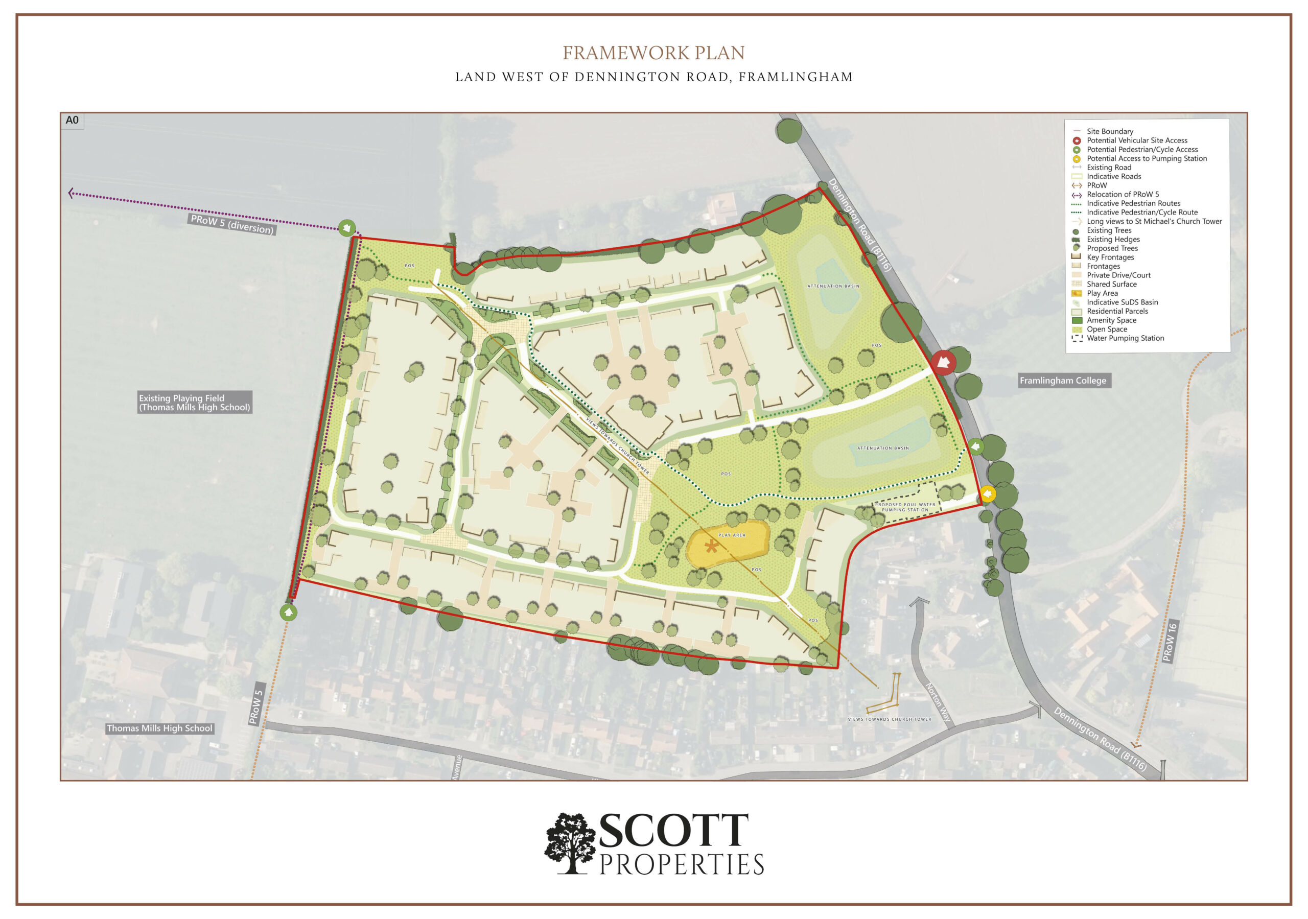
The Framework Plan shows a net developable area of c. 8.8 acres, which could accommodate up to 122 dwellings at an appropriate density for the local area. Vehicular and Pedestrian access is proposed via a new junction, footway and cycleway to Dennington Road – the details of this are provided on the Technical Information page.
The proposed built form is set back from Dennington Road behind areas of public open space which incorporate landscaped planting and drainage features. There is a central area of public open space including a children’s play area, with further public open space adjoining the western and north-western boundaries.
The Framework Plan includes a view corridor across the site towards the tower of St Michael’s Church, creating the opportunity for public appreciation of this view.
Public Footpath 5 is proposed to be rerouted inside the western boundary, in order to address the safeguarding issues associated with the current route across the school playing fields. This re-routing has been discussed and agreed with the Thomas Mills High School.
Select the image below to open the Framework Plan (opens in a new tab).